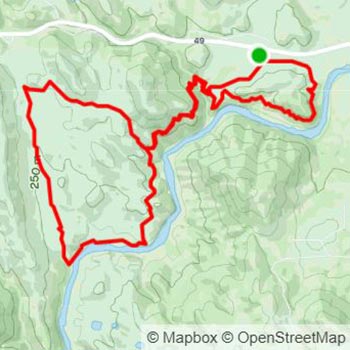
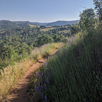
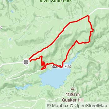
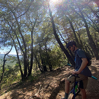
circular black and white logo of mountains and water

Foothill MTB

  • Share on Facebook
  • Tweet
  • Send email
three bike riders on a trail in forested mountains overlooking a lake

Ride the Foothills

See more of the Sierra Nevada by covering miles of trails by bike as you weave amongst the pines, flow by the rivers and lakes, and ascend to great heights. Find your balance with our curated trail guides so you can appreciate the natural surroundings with the confidence of a local rider.

arrow

Map Overview

Get your bearings with a bird's eye view of the many trailheads dotting the landscape of California's historic Gold Country.

Trail Guides

Drop in for more details on some of the best trails the Sierra Nevada region has to offer.

Pioneer Trail

trail map bike rider on wooded trail

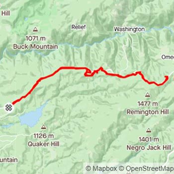
The trailhead is located at Harmony Ridge Market in Nevada City and stretches along Highway 20 until the Omega Diggins Overlook with expansive views of the Sierra. This point-to-point trail is heavily trafficked at the start but thins out as you cover more distance. The trail is best enjoyed from April to November with snow and mud limiting riding throughout the winter months.

  • Distance: 30 miles
  • Difficulty: Intermediate
  • Trail Type: Singletrack
  • Ride Type: Out and Back
  • Elevation Gain: 2,452 ft
  • Max Elevation: 5,160 ft

back to top

Magnolia to Cronan Loop

trail map dirt trail in mountains

The trail begins at Magnolia Ranch in Pilot Hill which is a moderately trafficked destination for hikers, bikers and horse riders with scenic views of the American River. The winding trail has a satisfying mix of flats interspersed with medium-intensity climbs and flowy downhills. Best enjoyed in the temperate weather of spring or fall.

  • Distance: 9 miles
  • Difficulty: Intermediate
  • Trail Type: Singletrack
  • Ride Type: Loop
  • Elevation Gain: 1,138 ft
  • Max Elevation: 783 ft

back to top

Scott's Flat Lake Trail Loop

trail map bike rider overlooking view from trail

Starting at the Harmony Ridge Market in Nevada City navigate across the highway to head down the Scott's Flat Lake Trail. Enjoy a fast switchback descent on the singletrack portion called Scott's Drop. After taking in the views of Scott's Flat Lake, begin the uphill grind via Casci Road which is a mix of paved, dirt and gravel fire road. Once back at Highway 20 cross over to pick back up at Pioneer Trail and head west to complete the loop.

  • Distance: 12 miles
  • Difficulty: Intermediate
  • Trail Type: Singletrack
  • Ride Type: Loop
  • Elevation Gain: 1,245 ft
  • Max Elevation: 4,106 ft

back to top

Hoot Trail

trail map dirt trail surrounded by plants

Start your ride at Harmony Ridge Market in Nevada City with flowy doubletrack and singletrack that brings you to the top of the very popular Hoot Trail. The downhill singletrack trail has a mix of pump sections, small jumps and high berms that will keep riders of all skill levels happy. The trail switchbacks down the ridge until reaching Rock Creek Road where riders climb up a gradual paved ascent back to the trailhead along Highway 20. Best enjoyed from April to November, but beware of dust and ruts in peak summer.

  • Distance: 4 miles
  • Difficulty: Intermediate
  • Trail Type: Singletrack
  • Ride Type: Loop
  • Elevation Gain: 559 ft
  • Max Elevation: 3,777 ft

back to top

Empire Mine State Historic Park

trail map bike rider approaching on trail

Trails meander through nearly a century of Gold Rush history with hardrock mining artifacts along the popular routes traveled by walkers, bikers and equestrians. Short segments make up a total of 14 miles of doubletrack trail throughout the park that can be combined to make routes for riders of all skill levels. Because the park is heavily trafficked, extra consideration should be made on descents, around blind corners, and when passing from behind.

  • Distance: 6 miles
  • Difficulty: Beginner
  • Trail Type: Double-Track
  • Ride Type: Loop
  • Elevation Gain: 784 ft
  • Max Elevation: 2,892 ft

back to top

Tahoe Flume Trail

dirt trail by mountainous lake

Take a shuttle from the Tunnel Creek Cafe up to Spooner Lake to begin a scenic ride that ends with breathtaking views of Lake Tahoe. There is an initial steep climb but the remainder of the trail is mostly flat which allows you to soak in the scenery. The trail is a mix of hardpacked and loose sand and has some narrow portions with steep drop-offs that will be more comfortably walked by less confident riders. The trail returns at the Tunnel Creek Cafe where riders can swap stories and photos over some hard earned food and drinks.

  • Distance: 14.5 miles
  • Difficulty: Intermediate
  • Trail Type: Singletrack
  • Ride Type: Shuttle
  • Elevation Gain: 1,353 ft
  • Max Elevation: 8,173 ft

back to top